

Rain in California: Timeline for Easter weekend storm
LOS ANGELES - Hang on to your umbrellas and prepare for a wet Easter weekend as yet another series of storms is expected to batter Southern California in the coming days.
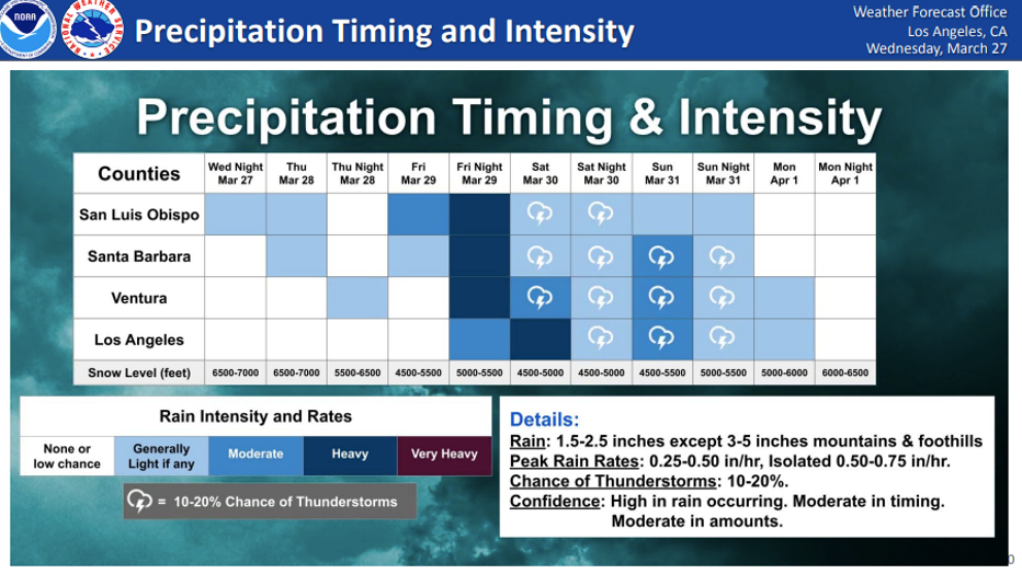
According to the National Weather Service, the "unseasonably cold and vigorous" storm system will move into the region between late Friday and Monday.
"Rain and mountain snow with a slight chance of thunderstorms will develop through Friday and Saturday, turning showery on Sunday and Monday," forecasters said.
Brief, heavy downpours could produce small hail, and there is also a chance for weak tornadoes or waterspouts over coastal waters due to the wind, according to the NWS.
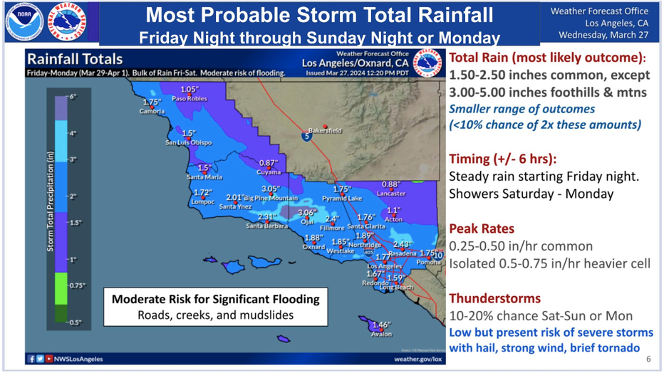
Rainfall totals are expected to be between 1.50 to 3 inches across the coast and valleys, with up to 5 inches possible along south-facing mountain slopes.
The bulk of the rain will slam the region, along with cooler temperatures, between Friday and Saturday, but a secondary storm could develop Sunday, bringing additional rainfall, meteorologists said.
In Los Angeles County, heavy rain is expected Saturday, with a 10-20% chance of thunderstorms up until Sunday evening. In Ventura County, heavy rain is expected Friday night, with a 10-20% chance of thunderstorms also up until Sunday night.
As far as snow totals, the current forecast estimates snow levels falling to 4,500 feet with the cold front, which could bring some accumulating snowfall to the Tejon Pass on the 5 Freeway. "A foot or two" of snow above 6000 feet is possible to impact higher roadways like Lockwood Valley Road in Ventura County and Angeles Crest Highway and Hwy 39 in Los Angeles County.
Strong, gusty winds will spread to the region Friday through Saturday as well, according to forecasters, with a High Wind Watch added for higher terrain in San Luis Obispo County. The potential for wind advisories to expand to more areas is likely for areas to the south and east into Sunday evening.
Get the latest weather updates by tapping or clicking here.