

Los Angeles rain: Preparations underway for back-to-back storms
Weather Forecast for Tuesday, Feb. 4
The latest forecast for the greater Los Angeles area, including beaches, valleys and desert regions.
LOS ANGELES - February is historically the wettest month in Southern California and the first full week of the month in 2025 is no exception.
After the region was devastated by three massive wildfires last month – the Palisades, Hughes and Eaton fires – crews prepared for potential debris flow in burn scar areas.
The first of two storms arrived late Monday night as the second storm was forecast to hit by Thursday.
Get the latest weather updates in Southern California below.
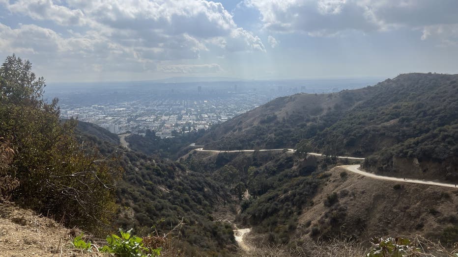
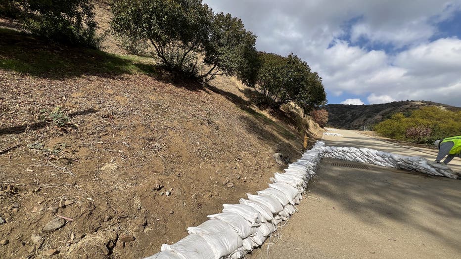
Storm preps at the site of the Sunset Fire
(Kelli Johnson KTTV)
11:45 a.m.: In anticipation of the storms, crews with the City of LA's Department of Recreation and Parks were seen placing sandbags at Runyon Canyon in Hollywood, the site of the Sunset Fire.
(Kelli Johnson KTTV)
Anticipated rain totals
8:15 a.m.: According to the National Weather Service, LA and Ventura counties will receive about a quarter to three-quarters of an inch in most areas, but as much as 1.5 inches in hills and mountains, including the Palisades and Eaton burn scars.
SoCal braces for more rain
A pair of storm systems are expected to dump rain on Southern California beginning Tuesday, again raising fears of possible debris or mud flows in recent burn areas.
PCH to close by Tuesday afternoon
5:50 a.m.: In preparation of back-to-back storms, CalTrans will close Pacific Coast Highway between Chautauqua Boulevard in Los Angeles and Carbon Beach Terrace in Malibu until at least Friday.
PCH closure set for Tuesday afternoon
Caltrans will close a section of PCH from Tuesday through Friday as two rainstorms are forecast to hit Southern California.
Southern California braces for back-to-back storms
5:20 a.m.: FOX 11 Meteorologist Soumada Khan said models show the first storm should hit by Tuesday evening.
Weather Forecast for Tuesday, Feb. 4
The latest forecast for the greater Los Angeles area, including beaches, valleys and desert regions.
Gov. Newsom tells Californians to prepare
5:15 a.m.: Gov. Gavin Newsom issued a statement and said the state has pre-deployed resources in anticipation of the storms.
"We’re pre-deploying significant resources and thousands of personnel to protect the safety of our California communities during this significant weather event. Californians should take precautions now as we anticipate a few rounds of storms in the coming days."
Majority of California remains under drought conditions
5:00 a.m.: While heavy rainfall struck Northern California, the same was not expected for the southern part of the Golden State.
Nearly 54% of the state is officially in drought conditions, with extreme levels reported in some of the same fire zones.
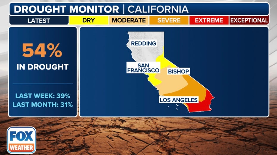
(FOX Weather)
Since the storm track is not expected to be directly over Southern California, more modest chances of precipitation are expected over cities and communities such as Los Angeles and San Diego, where as much as three-quarters of an inch of rainfall is possible this week.
Rainy week ahead
4:00 a.m.: The National Weather Service said two storm systems were expected to hit the region all week, with the heaviest rain expected in Ventura County.