Pineapple Express headed for California with flooding, wind, snow expected this week
Weather Forecast for Tuesday, Jan. 30
The latest forecast and air quality conditions for the greater Los Angeles area, including beaches, valleys and desert regions.
All aboard the Pineapple Express this week in California as some coastal ranges could see over 8 inches of rain before the end of the week, while Los Angeles and San Diego could be in for more monumental flooding.
The Pineapple Express is an atmospheric river that sets up a fire hose of moisture starting near Hawaii and blasts the West Coast. That atmospheric river can carry up to 27 times the amount of water carried by the Mississippi River, which is the equivalent of up to 10-15 inches of rain.
"What we've got going now is a very active period when the the upper-level jet is stretching across the Pacific," Marty Ralph, director of the Center for Western Weather and Water Extremes, told FOX Weather on Monday. "There's a lot of moisture being transported in a series of atmospheric river storms associated with that. And they're sort of stalled a bit over the Northwest for a few days here. And soon they're going to move down the coast along into California."
Significant impacts:
Early this week, moisture from the Pineapple Express will branch north and soak Washington and Oregon. The system is warm, so forecasters in the area don't expect snow. The National Weather Service in Seattle calls for the possibility of record warmth through Tuesday.
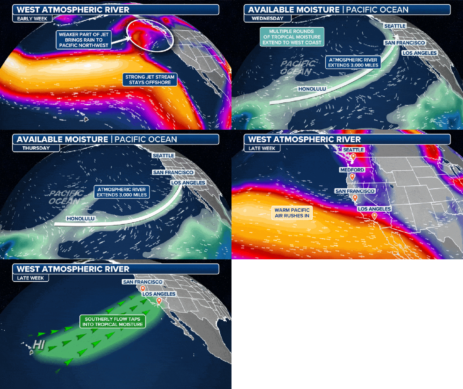
The atmospheric river rides the jet stream to soak the Pacific Northwest early this week, then shifts south through late-week. (FOX Weather)
Any rain will add to the already-saturated ground the area has previously seen, so river levels will be on the rise, and some flooding is possible, along with a landslide risk.
"The good news here is it's going to be strong, it's going to be heavy at times, but it's going to be transient – it's going to be moving pretty quickly," FOX Weather Meteorologist Bob Van Dillen said. "So it's not going to be at the same spot for a long period."
"But even with that, look how much rain we're looking at across Northern California, essentially starting on Wednesday," he continued. "That orange-shaded area is 3 to 5 inches of rain (in the Bay Area) in Northern California. Up here, it's about 5 to 8 inches of rain."
Above pass level, the Sierra Nevada could see 1-3 feet of new snow.
"Very few ensemble members are showing AR (atmospheric river) 5. Numbers are showing here for the majority are showing AR 3 right now in the Northwest, and then getting into Central California/Northern California, AR 3 conditions look to be most likely. And Southern California could even get AR 1," explained Ralph.
WHAT DOES A ‘CATEGORY 5’ ATMOSPHERIC RIVER MEAN? SCALE AIMS TO RATE NATURES LARGEST SOAKERS
Timing:
Tuesday
The third and strongest of a series of three atmospheric river storms makes landfall Tuesday in British Columbia, Canada, and pushes south. River flooding in the coastal Pacific Northwest is possible.
"(We have) rain already across Oregon now starting to get into California," Van Dillen said. "That's Tuesday evening."
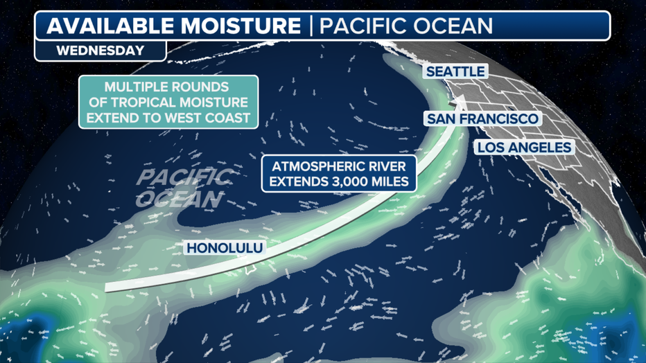
The atmospheric river plows into Northern California midweek (FOX Weather)
Wednesday
"Wednesday morning into Wednesday afternoon, the rain starts stretching through the northern sections of California, and higher elevations get a little bit of snowfall," Van Dillen said.
Flash flooding is likely north of the San Francisco Bay Area, where the heaviest rain is forecast to fall.
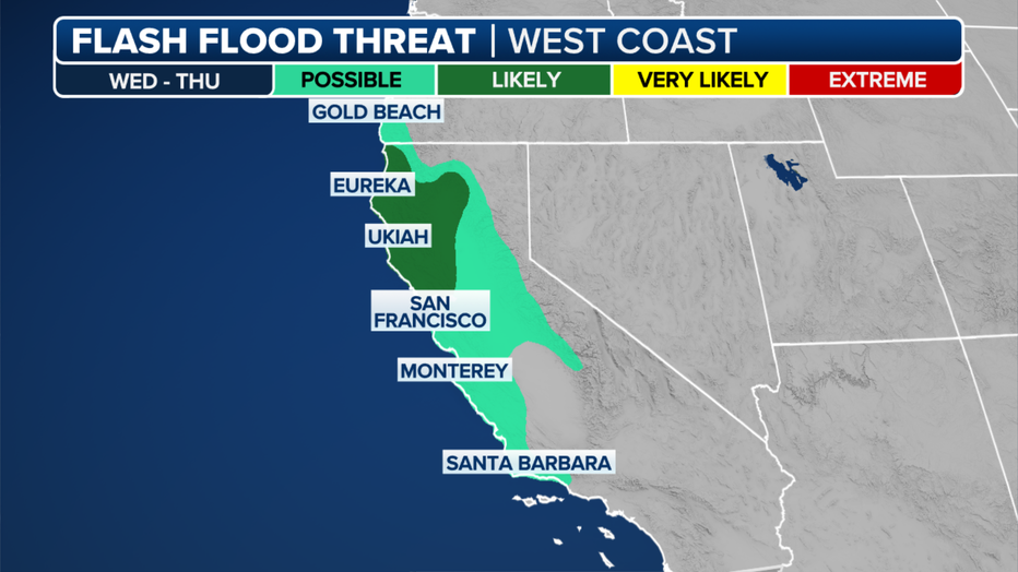
"Shallow soils on steep hillslopes are approaching saturation," wrote the San Francisco NWS office in an advisory. "This coupled with the forecasted precipitation means widespread shallow landslides are likely."
The NWS issued a High Wind Watch for areas of Oregon and California from late Tuesday through Wednesday. Winds are forecast to blow out of the southeast from 25-35 mph and gust up to 65 mph. The strongest winds are expected late Wednesday morning through the afternoon.
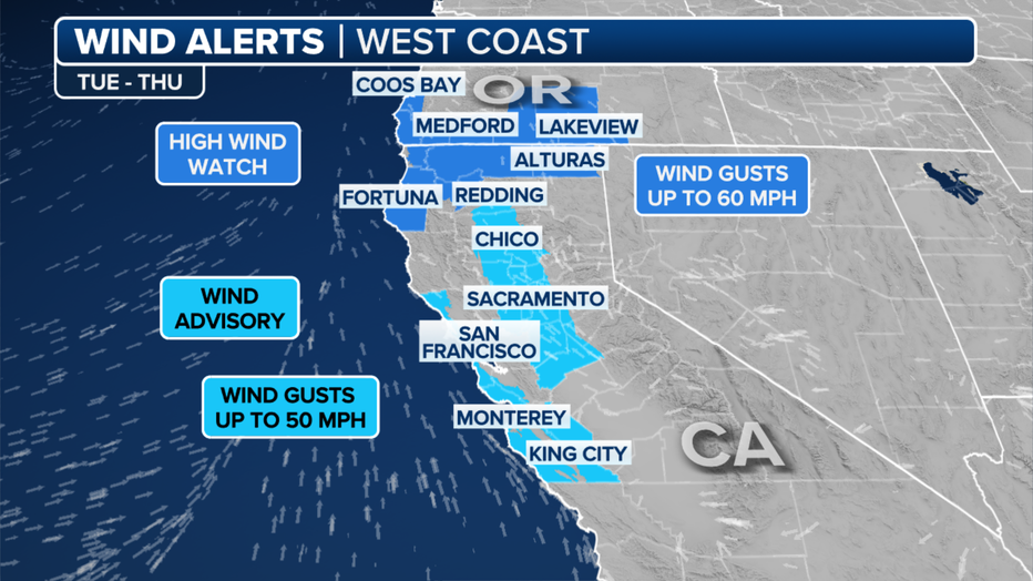
The atmospheric river hits Northern California the hardest midweek, then shifts to Southern California. (FOX Weather)
"Damaging winds could blow down trees and power lines," the NWS warned. "Widespread power outages are possible. Travel could be difficult, especially for high-profile vehicles."
Thursday
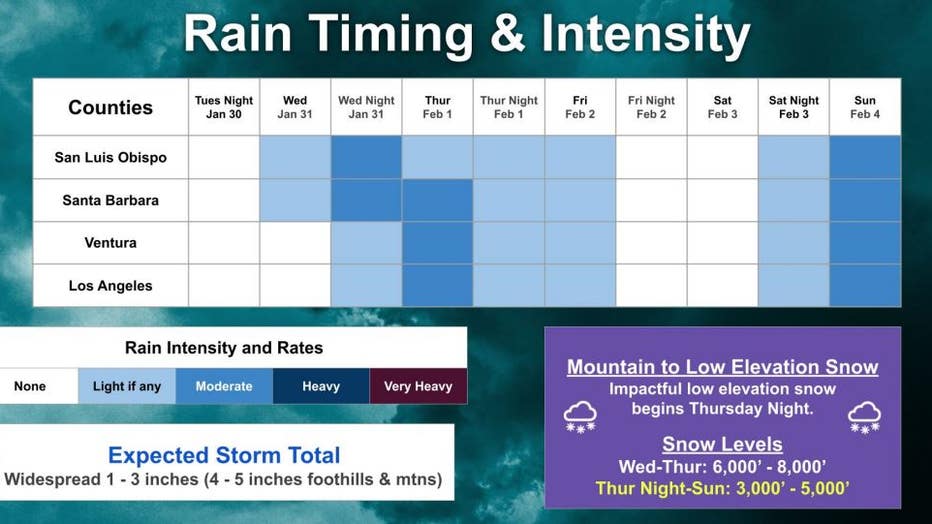
"And then Wednesday afternoon into Thursday, it really comes on strong and moves right down through lower parts of California," Van Dillen said. "Look at L.A., San Diego. You're in it to win it again with more rain, but not as heavy as what we had last week. That's the good news."
Still, coastal Southern California is at risk for flooding, especially along rivers.
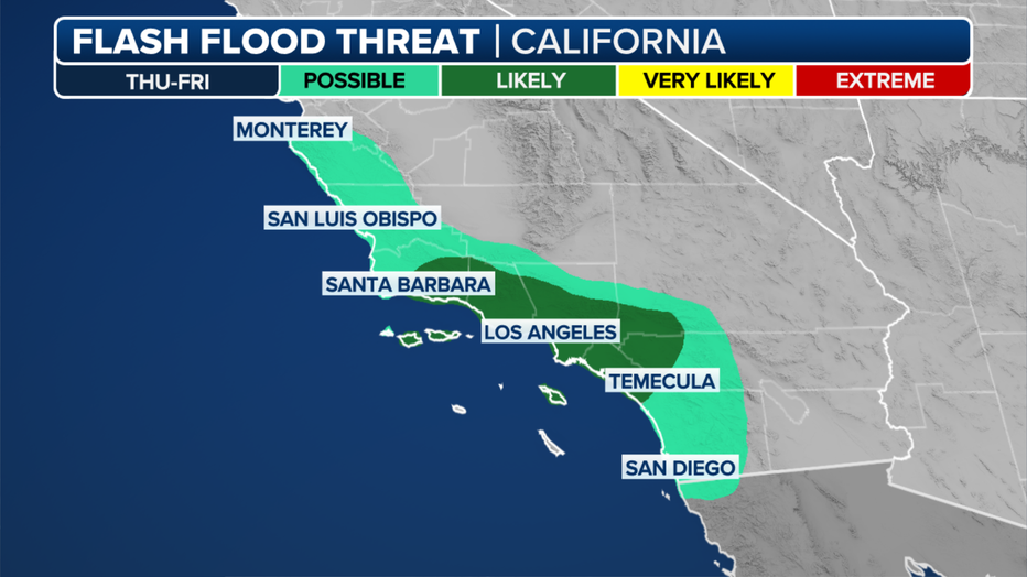
Flash flooding is likely across Southern California on Thursday. (FOX Weather)
Friday to Monday
The heaviest rain moves through Los Angeles and San Diego counties by late Thursday. Showers will continue Friday. The rain then makes its way through Arizona and even New Mexico into the weekend.
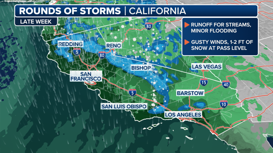
The atmospheric river hits Northern California the hardest midweek, then shifts to Southern California. (FOX Weather)
"The Climate Prediction Center (CPC) has already indicated a moderate risk for heavy precipitation, heavy snow and high winds for regions in the western U.S. and possible flooding along the California coast and in Arizona for Feb. 2 through Feb. 5," wrote the Center for Western Weather and Water Extremes.
"Snow, it's coming in, and that could be pretty decent for higher elevations, Sierra Nevada range all the way through the Four Corners and northern Nevada," Van Dillen said.
Get the latest updates on this story on FOXWeather.com.

