

Santa Ana winds returning to Southern California with wind gusts of up to 45 mph
Weather forecast for Thursday, Feb. 27
The latest forecast and air quality conditions for the greater Los Angeles area, including beaches, valleys and desert regions.
Santa Ana winds are returning to Southern California with wind gusts peaking up to 45 mph for parts of the region.
What we know:
According to the National Weather Service, the Santa Ana winds will impact parts of the 5 Freeway corridor, Ventura County and the Santa Barbara Channel. In addition to the expected strong winds, dense fog with very low visibilities will linger over Los Angeles' coastal and beach communities. The fog and the strong winds will hang around Southern California through Thursday, NWS said.
The good news, possibly the most important note for Angelenos: Fire risks are very low due to recent rains, NWS said.
By the numbers:
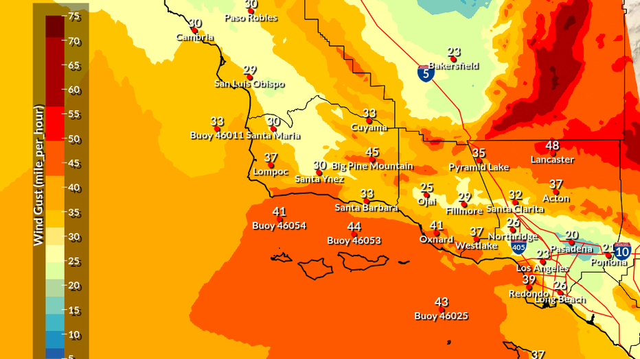
Below are the peak wind gusts, according to NWS (mph):
- Los Angeles: 15
- Ontario: 30
- Pasadena: 18
- Pomona: 17
- Long Beach: 16
- Northridge: 31
- Santa Clarita: 44
- Lancaster: 35
- Corona: 30
- Anaheim: 35
- Pyramid Lake: 47
- Fillmore: 47
- Westlake: 37
- Oxnard: 41
In addition to strong winds, it will also be warm, especially in the Inland Empire.
Timeline:
NWS says the Santa Ana winds will blow through Southern California between Wednesday night and into Thursday.
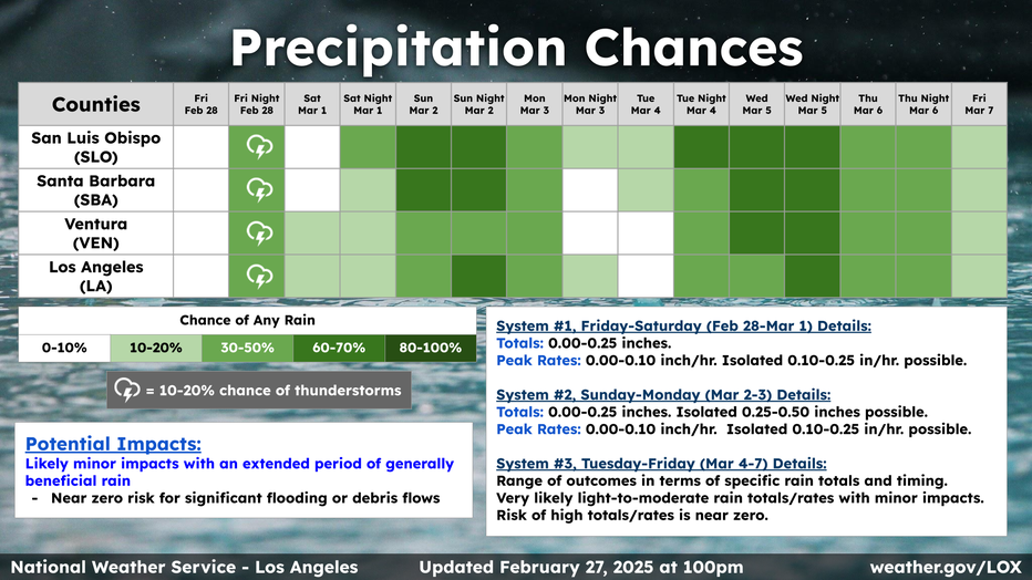
Los Angeles is under a fair chance of seeing rain and 10-20% chance of seeing thunderstorms on Friday night. Rain is expected for parts of Saturday morning/afternoon with a high chance of rain Sunday, NWS said.
The backstory:
The news of minimal fire risk is a very welcome sight after Southern California dealt with nonstop fires in January 2025.
While the causes of Eaton and Palisades fire have not been formally announced as of February 26, the piercing winds on January 7 contributed to the two fires stretching up to 50,000 acres during the worst of times.
The Source: Information for this story is from the National Weather Service.